Let’s Talk Science: Mapping
02-21-2018
Category: Scientific Work
Welcome to our blog series, “Let’s Talk Science,” where we break down the science behind our team’s work. Over the past couple weeks, we’ve talk about how our team uses satellites and clues on the ground to create the maps of Antarctica. Today, we will look at some of those maps!
Has it been a while since you’ve read the other posts? No worries! Use the links in the article to go back and refresh your memory.
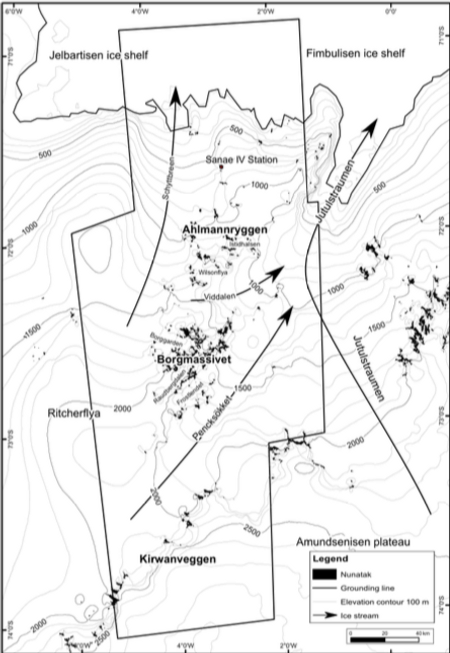
We use remote sensing images to see the ice from a bird’s eye view. Check out the results! In the map below, you can see the research stations Wasa, SANAE IV, and Troll. You can also see many nunatak ranges like Ahlmannryggen, Borgmassivet, and Kirwanveggen.

Credit: Elena Serra
Our maps can show us wide areas of ice, or we can zoom in and study specific nunataks. When we do, we don't want to forget to use information we gathered in the field, because the remote sensing interpretation is not always correct. In the picture below, the red areas were interpreted as bedrock outcrops and the black ones as sediment cover, but ground check is needed to confirm this distinction.
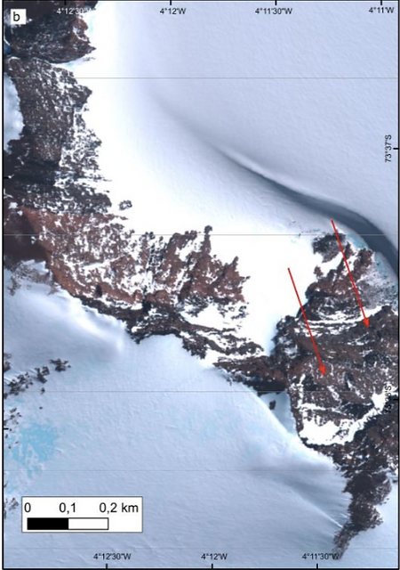
Credit: Elena Serra
We can also use our maps to show where we found ice streams. Ice streams are areas in which the ice moves much faster than in the surrounding. In the map below, the ice streams are represented by the arrows. These ice streams even have names! The four in the photo are called Schyttbreen, Viddalen, Pencksokket, and Jutulstraumen.
Credit: Elena Serra
We can also see erratic boulders thanks to the high resolution of the images. In the map below, the red arrows point to erratic boulders the team identified using remote sensing technology, but again ground validation is needed.
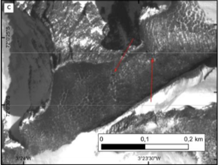
Credit: Elena Serra
Maps are pretty cool, and they let us do a lot of other work (modeling and measuring) too! Special thanks to Elena Serra of Stockholm University for letting us show off her work.
Got a science question for us? Leave it here and we can answer it for you. Maybe we’ll even feature it in our blog!
#LetsTalkScience #Mapping #Education