Let’s Talk Science: Mapping and Verification
01-25-2018
Category: Scientific Work
In our last article, we began explaining how remote sensing helps us with our mapping, the first “M” of our acronym. We use this to begin to create geomorphological maps (maps that show the landscape features on the Earth’s surface produced by geological processes). The next strategy we use is field mapping and verification.
Not all the mapping of ice and rock surface features we need can be done through our satellites. Some of it needs to be done hands on “in the field” (in the field means actually going to the places shown on the map). Geomorphological mapping and verification helps us to check the satellite-based maps and to add important new details to our maps, in particular small features that are produced by changing ice levels. Those clues help us learn more details about how the ice thickness has changed over time.

Geomorphological mapping is a lot like being a detective and looking for clues. When a bad guy runs away, sometimes he leaves behind a footprint. Ice and rocks do something similar when they move or change – they leave geomorphological “footprints”. Our job is to find clues that help us understand how the ice and rocks have been moving or changing.
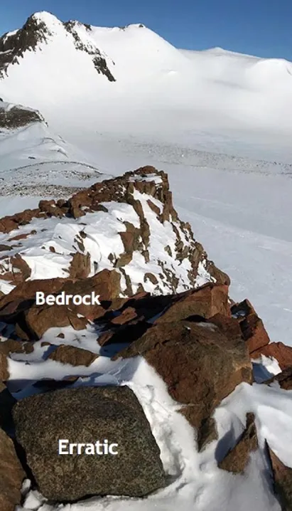
Antarctica might be cold, but our team goes outside into the field to find these clues. Erratics, and striations are two important clues we try to find out on the rock surfaces. Erratics are like debris left behind by a suspect. They are sections of rock that have been plucked from one area and drug along to another with the moving ice. As the ice melts, the erratics drop out in a new place. These clues help us understand where the ice was once moving.
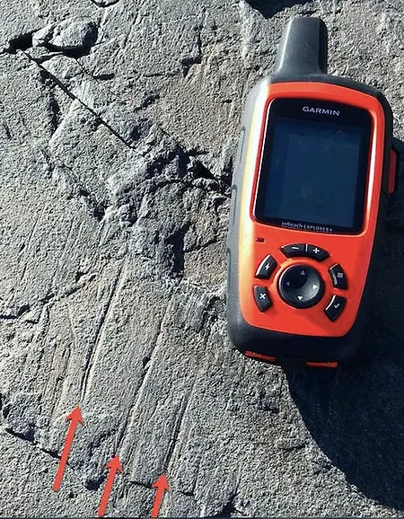
Striations are like footprints. They are scratches or grooves on one side of rock that ice once passed over. Glaciers are among the most erosive processes on the planet. It is hard for them not to leave their mark! The red arrows in the picture below show you what a glacial footprint might look like.
Once we have enough clues, we can combine that information with what our satellites captured with remote sensing. Then not only do our maps tell us what the ice looks like right now, but they can also tell us even more information, like what they looked like in the past. This also helps us work out how they may change in the future.
Have a science question for us? Leave it here and we can answer it for you. Maybe we’ll even feature it in our blog!
#Mapping #LetsTalkScience #FieldWork