To Tottanfjella and back – our second major field excursion
02-14-2017
Category: Scientific Work
In our first major expedition from Wasa, we visited Milorgfjella, the northeasternmost nunatak in the Heimefrontfjella (pronounced ‘Hime-a-front-fyella’) range, for evidence of past glacial cover at a range of altitudes above the modern ice surfaces. Unfortunately our Arctic Trucks could not reach higher altitude sites in that area due to deep, dry, sugary snow on steep ground, so we were forced to concentrate on lower altitude samples. After returning to Wasa on 26 January, our logistics team devised a hybrid plan for our next expedition to improve our ability to reach high altitudes. In a heroic effort, the three logistics personnel who had remained at Wasa (Pär, Karin, and Stefan) for the Milorgfjella trip used both trucks and a trailer borrowed from the Finnish Aboa station next door to Wasa to deliver two snowmobiles (ski-doos) plus extra fuel to an established fuel depot adjacent to Sweden’s first outpost in Antarctica, the Svea hut in the Sivorgfjella (pronounced ‘See-vorg-fyella’) range, and then returned to Wasa in less than 24 hours (!) – about 320 km round trip at typically 20-30 km/hr (12-20 mph)! The advantage of the ski-doos is that they can travel much more easily on soft snow, greatly expanding the range of possible sites to visit.

Figure 1 - From whence we came… (Photo: Nat Lifton)
On our friends’ return, we loaded the trucks with our equipment and on 30 January we set out in sunny weather on our second major expedition to explore the southern reaches of Heimefrontfjella (Figure 1) – specifically the clusters of nunataks (mountains protruding above the ice surface) known as Tottanfjella (Figure 2). We made good time to the fuel depot, arriving about 8 hours after departing Wasa. We fueled up both trucks and drove the trucks and ski-doos another 2 hours south to our camp site at Kiberg (pronounced ‘she-berg’), located along an established route to the high plateau passing between Sivorgfjella and Tottanfjella. We set up camp, ate a late dinner and slept well after our long travel day.
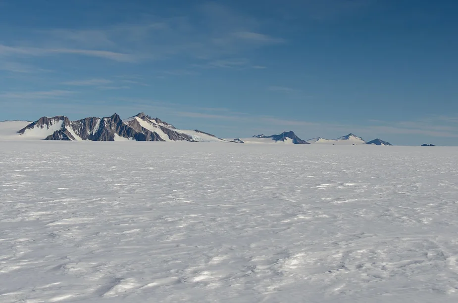
Figure 2 - Tottanfjella, with the Johnsonhogna, Cottontoppen, and Vardeklettane/Ardusberget nunataks from left to right (Photo: Nat Lifton)
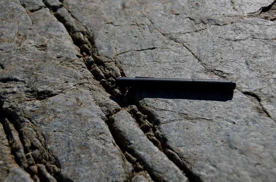
Figure 3 - Rock outcrop exhibiting glacial polish and striations parallel to the eraser as well as some at an angle to it below and to its left. (photo credit Nat Lifton)
The next day was a reconnaissance day, with 6 of us scouting out access to potential sites of interest in the spectacular Johnsonhogna (pronounced ‘yonson-hogna’) range (Figure 3) and adjacent Månisigden (pronounced ‘moen-is-ig-den’) ridge with the 4x4 and ski-doos, while our two Henriks ventured southward scouting a route to the Vardeklettane (pronounced ‘var-de-kle-ta-na’) nunataks in the southern reaches of Tottanfjella. Over the following 5 days, we searched for sites with evidence of glacial activity: either from glacial ‘erratics’ (rocks transported long distances by glaciers and dropped at a site) or from bedrock rounded and polished by the sliding glacier (especially when the rock has characteristic scratches, known as striations, preserved in the polished surface) (Figure 4). Tottanfjella spans a huge distance, and travel to and from each sample site often took 1-2 hours each way, so we continued to split into separate teams each day to cover more area. In addition to Johnsonhogna, Månisigden, and Vardeklettane, during our stay we also visited Bowrakammen (pronounced ‘bove-ra-kammen’) ridge, Cottontoppen (Figure 5) and an adjacent small nunatak we nicknamed “Cottontoppen Junior” (Figure 6), and the ridges known as Flisegga (pronounced ‘fleece-egga’) and Flisbrekka. In addition, a small team was able to use ski-doos to investigate little nunataks (we call them ‘wanna-be’ nunataks) emerging from the high ice sheet plateau above Tottanfjella.
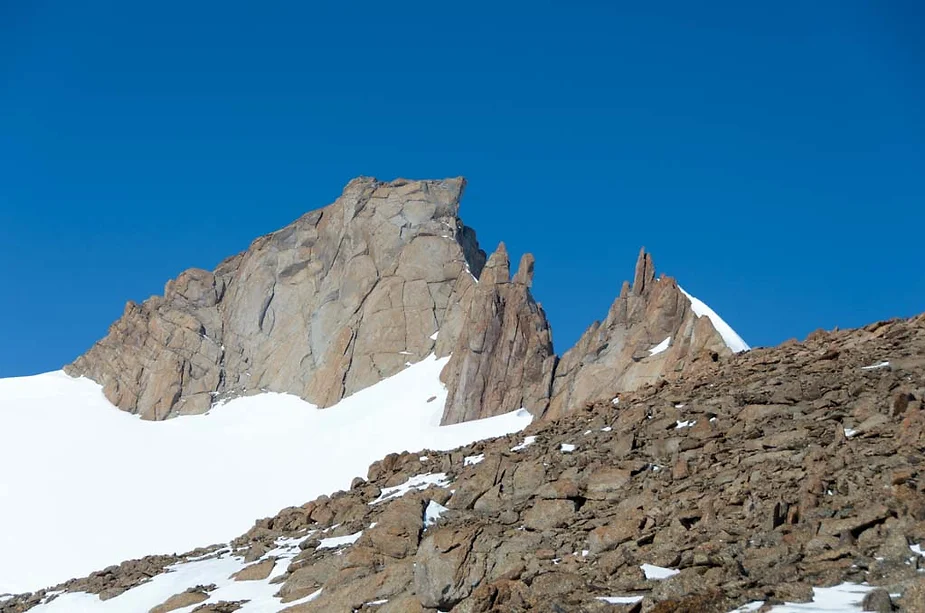
Figure 4 - Highest peak of Johnsonhogna, 2221 m above sea level (Photo: Nat Lifton)
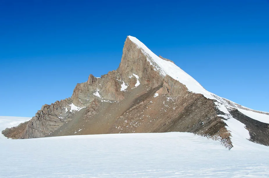
Figure 5 - Cottontoppen peak – spectacular! (Photo: Nat Lifton)
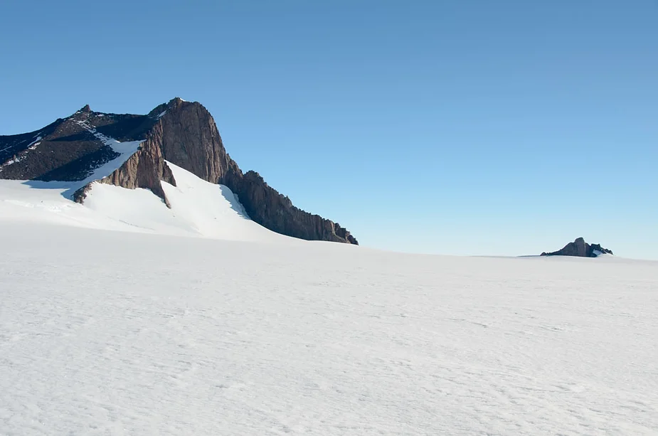
Figure 6 - Like father, like son… Cottontoppen and “Cottontoppen Junior” (Photo: Nat Lifton)
Unfortunately, the structure and types of the rock in Tottanfjella largely conspired against us in our search for samples. Most of the rock types at the sites we visited had a dominant vertical fracture pattern. Combined with long- and short-term cycles of freezing and thawing of ice in the fractures that continually push the fractures open (water expands when it freezes), this means that the ridges and slopes are covered mostly by small slabs or blocks of rock that did not preserve any characteristics of glacial cover (Figure 7); basically, the bedrock outcrops are blown apart by this process of frost-shattering. In addition, many of the rock types broke apart too easily grain-by-grain to preserve glacial evidence. Our persistence did allow us find exceptions to this, though, and we returned with a number of excellent samples that we can use to constrain if and when the ice was at a particular location, using analytical methods to be described in a future post.
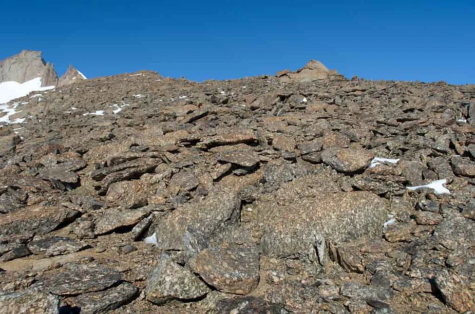
Figure 7 - Blocks of shattered bedrock covering a ridge on Johnsonhogna (Photo: Nat Lifton)
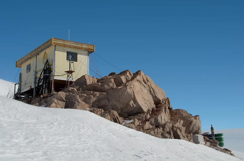
Figure 8 – Svea station (Photo: Nat Lifton)
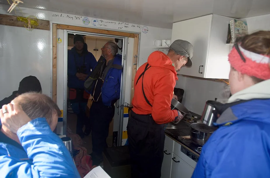
Figure 9 – Coffee and lunch in Svea (Photo: Nat Lifton)
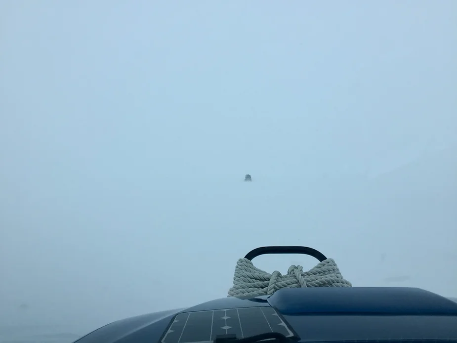
Figure 10 – White-out! 6x6 in front (Photo: Nat Lifton)
We returned to Wasa on 6 February, having exhausted all possibilities for potential sites that we could access safely in the area that we also judged to be worth investigating. We stopped at the Svea hut on the return trip for some equipment maintenance and to visit a piece of history and enjoyed some lunch and coffee inside (Figures 8 & 9). Designed to accommodate 4 people, it was quite cramped for 8 of us, but it was a great place to escape the cold wind! We encountered a snowstorm after that on the way back to Wasa and drove for about 4 hours in white-out conditions – the snow wasn’t so bad but we often couldn’t see any distinction between the sky and ground (Figure 10). Disorienting, to say the least, but our trusty GPS units in the trucks got us back home safely.
‘Till next time…
Nat Lifton
#WasaStation #FieldWork