The Nunataks of Norway – testing equipment and concepts in preparation for our Antarctic fieldwork
10-25-2016
Category: Expedition Preparation
The Scandinavian mountains and the East Antarctic Heimefrontfjella mountain range (where our fieldwork is based) have several characteristics in common. Hans Wilhelmsson Ahlmann, former Professor in Geography at Stockholm University, pointed out this interesting fact almost 100 years ago. The most obvious difference between East Antarctica and Scandinavia is of course that Heimefrontfjella today is surrounded by, and partly covered by the East Antarctic ice sheet, whereas the Scandinavian mountains are ice-free. However, what Heimefrontfjella looks like today, Scandinavia looked like 20,000 years ago! In both cases the mountain ranges act(ed) as barriers to a huge ice sheet, with ice flowing from the interior out towards the margin. The mountain ranges have (in Heimefrontfjella today) and had (in Scandinavia 20,000 years ago) nunataks protruding through the ice. These nunataks can be used to measure past ice sheet thickness.

Looking towards the northeast from the slopes of Stetind mountain, Norway. About 20,000 years ago the ice divide of the Fennoscandian ice sheet was located hundreds of kilometers to the east, forcing ice to flow through the Scandinavian mountains. The dramatic topography in northern Norway is, to a large extent, shaped by ice sheets.
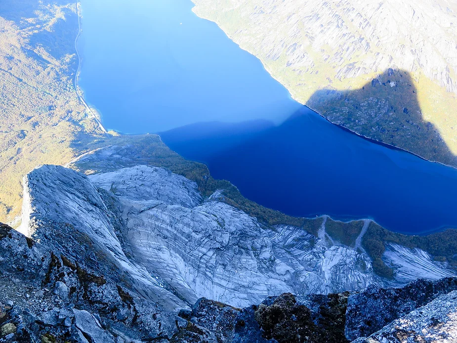
About 2 km of vertical relief - from the summit of Stetind (1391 m a.sl.) to the bottom of fjord Stefjorden - carved by Quaternary glaciers and ice sheets. Note the iconic profile of Stetind in the shadow.
For our upcoming field season in Antarctica, we have bought some new equipment that should, hopefully, make the fieldwork a little easier. To help with mapping and navigation we have acquired rugged GIS (Geographic Information System) enabled tablets (also known as toughpads) that will show us precisely where we are on the high-resolution satellite images that we are mapping. To help with precise rock sampling we have bought lightweight, high-power drill hammers and rock wedges – a system that has been used successfully in Antarctica before. We wanted to test these tools before using them in Antarctica! And to do this we decided to sample some nunataks in northern Norway.
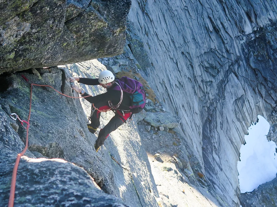
The climb up Stetind was mostly a scramble, but the last 500 m of the summit ridge required rock climbing equipment and sometimes the use of both hands and feet. Ola ponders the exposed situation with several hundred meters of air beneath his feet.
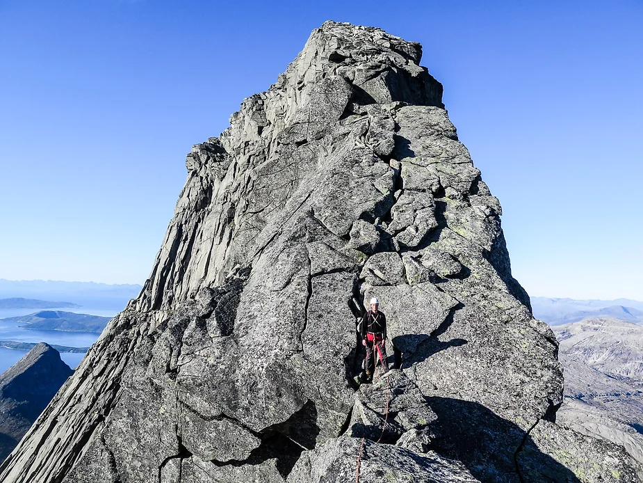
The last leg up the ridge towards the summit of Stetind.
Sampling for cosmogenic nuclides using good old chisel and hammer. Our questions here are: When was the summit plateau deglaciated? How much have Quaternary glaciers and frost weathering eroded the summit? To answer these questions, we need to measure multiple cosmogenic isotopes, for example 10Be, 26Al, and perhaps the stable isotopes 3He and 21Ne.
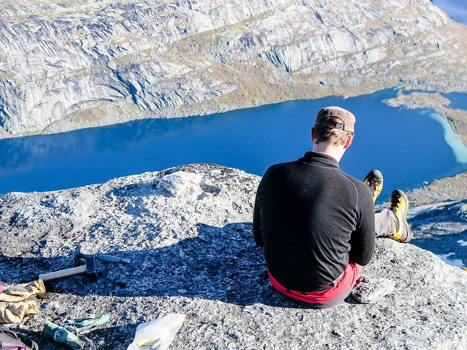
We had a beautiful time in northern Norway with spectacular, sunny, fall weather. Some of our equipment was thoroughly tested and we feel confident to do a good job this coming season in Antarctica. Perhaps we could have asked for colder and windier weather to better test ourselves and the gear…
#Nunatak #FieldWork #Training